


I still remember the first time I tried to explain how does gps work to my niece – she was fascinated by how her tablet could pinpoint our location in the park. As a former hardware engineer, I’d spent years designing chips for smartphones and laptops, but found that explaining the underlying technology to non-techies was a daunting task. It frustrated me to see complex concepts like GPS being oversimplified or, worse, explained with overly technical jargon that left people more confused than enlightened. I believe that understanding how does gps work shouldn’t require a Ph.D. in engineering.
In this article, I promise to break down the mystery of GPS into simple, understandable bits, using everyday analogies and real-world examples to illustrate the concepts. My goal is to empower you with a genuine understanding of how GPS technology works, without resorting to hype or complicated terminology. By the end of this journey, you’ll be able to explain how does gps work to a 10-year-old, and that’s when you’ll know you truly get it. So, let’s embark on this adventure together and uncover the fascinating world of GPS, one straightforward explanation at a time.
Table of Contents
How Does Gps Work
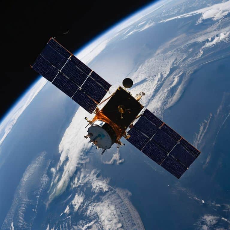
To understand how GPS works, let’s start with the basics. The Global Positioning System is made up of a network of satellites orbiting the Earth, which send out gps signals that can be received by devices on the ground. These signals contain information about the satellite’s location and the time it was sent, allowing GPS receivers to calculate their own position.
The accuracy of GPS depends on several factors, including _gps signal strength factors_ such as the number of satellites in view and the quality of the signal. Weather conditions, like heavy cloud cover or ionospheric interference, can also impact the accuracy of GPS. However, modern GPS systems are designed to mitigate these effects and provide reliable location information.
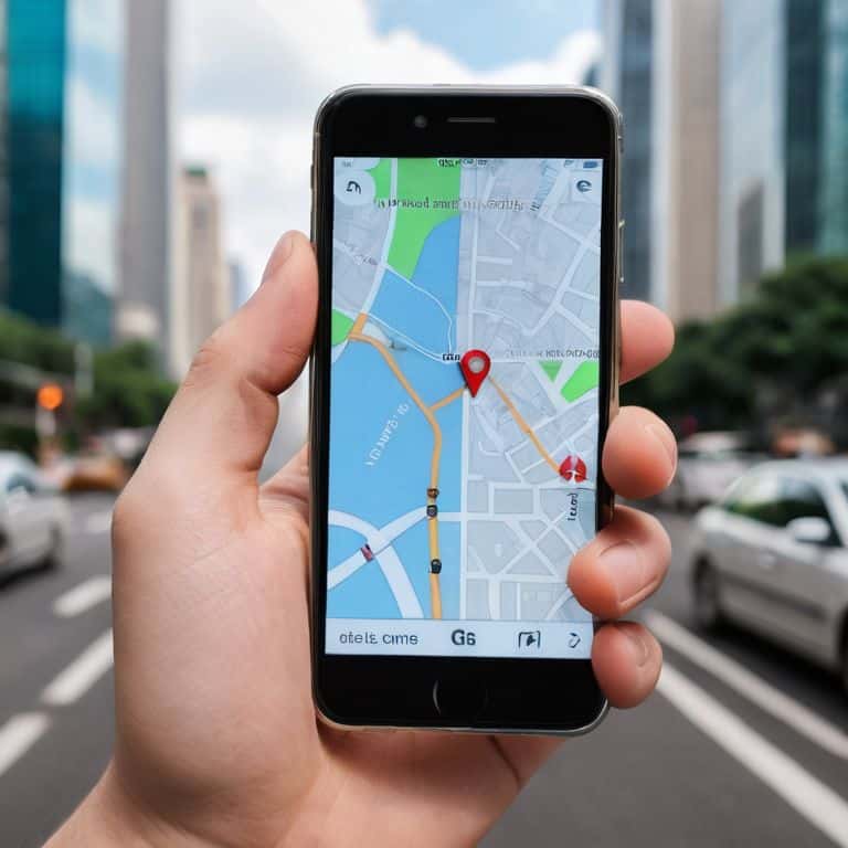
In comparison to other satellite navigation systems, like _GLONASS_, GPS offers a more extensive network of satellites, resulting in better coverage and more accurate positioning. This has led to the widespread adoption of GPS in various applications, including gps and mapping applications that enable users to navigate unfamiliar territories with ease.
Gps Signal Strength Factors Explained
When we talk about GPS signal strength, there are several factors at play. One of the key factors is the line of sight between the GPS satellite and the receiver. If there are obstacles like buildings or trees in the way, the signal can be weakened or even lost. Think of it like a garden hose – if you kink the hose, the water flow is reduced, and if you block the end of the hose, no water comes out at all.
The signal-to-noise ratio is another crucial factor in determining GPS signal strength. This refers to the balance between the desired GPS signal and any unwanted signals or interference. A high signal-to-noise ratio means the GPS signal is strong and clear, while a low ratio can make it difficult for the receiver to accurately determine its location.
Understanding Gps Accuracy Demystified
To grasp how GPS works, we need to delve into the concept of accuracy. Think of it like a plumbing system, where the water pressure (or in this case, the signal strength) affects the overall flow. Signal interference can be a major factor in determining the accuracy of GPS readings.
When we talk about GPS accuracy, we’re essentially discussing the margin of error. This margin can be influenced by various factors, including the number of satellites in view and the quality of the receiver itself.
Beyond Basics Gps Nuances

As we delve deeper into the world of GPS, it’s essential to consider the gps signal strength factors that affect its performance. You see, GPS signals are like water flowing through pipes – they can be disrupted or weakened by various obstacles, such as buildings or trees. This is where understanding gps accuracy becomes crucial, as it helps us appreciate the complexities of GPS technology.
One of the key nuances of GPS is the difference between gps vs glonass systems. While GPS is the most widely used system, GLONASS is a Russian-based alternative that offers similar functionality. By understanding the strengths and weaknesses of each system, we can better appreciate the impact of weather on gps signals. For instance, inclement weather can weaken GPS signals, making it more challenging for devices to pinpoint their location.
In addition to these factors, passive gps tracking methods have become increasingly popular. These methods allow devices to track their location without actively transmitting signals, which can be useful in certain situations. Furthermore, the integration of GPS with gps and mapping applications has revolutionized the way we navigate our surroundings. By combining GPS data with mapping technology, we can create highly accurate and detailed maps that make it easier to find our way around.
Gps vs Glonass Choosing the Best
When it comes to satellite navigation systems, two prominent players are GPS and GLONASS. The main difference between them lies in their geographical coverage, with GPS being a more global network and GLONASS providing better coverage in high-latitude regions.
In choosing the best system, signal strength is a crucial factor. While GPS is widely used and has a strong network, GLONASS offers a more localized approach, which can be beneficial in certain situations, such as in Russia and surrounding areas where its coverage is more extensive.
Impact of Weather on Gps Signals
When it comes to GPS signals, the weather can play a significant role in their strength and accuracy. Atmospheric conditions, such as heavy rain or dense fog, can weaken the signal, making it more difficult for GPS receivers to get a precise location. This is because the signal has to travel through more water vapor and particles in the air, which can scatter and absorb the signal.
The signal delay caused by weather conditions can be significant, especially in areas with heavy precipitation or high levels of air pollution. This delay can result in a less accurate location reading, which can be problematic for applications that require precise positioning, such as aviation or maritime navigation.
Navigating the World of GPS: 5 Key Tips to Get You Started
- Understand the importance of satellite geometry: just like how a plumber needs to consider the layout of pipes to ensure proper water flow, GPS signals from multiple satellites are necessary for accurate location determination
- Know your GPS signal strength factors: think of signal strength like water pressure in a hose – too little pressure (or signal strength) and you won’t get the flow (or location accuracy) you need
- Choose the right GPS system for your needs: consider GPS vs GLONASS like choosing between two different types of internet service providers – each has its own strengths and weaknesses
- Be aware of weather conditions: just as a radio signal can be disrupted by a thunderstorm, GPS signals can be affected by weather, so it’s essential to understand how to minimize these effects
- Use assistive technologies to enhance GPS accuracy: think of assistive technologies like A-GPS or WAAS as a special kind of signal booster, helping to improve location accuracy in areas with limited satellite visibility
Key Takeaways: Navigating GPS with Clarity
GPS signal strength and accuracy are influenced by a combination of factors including satellite geometry, atmospheric conditions, and physical obstructions, which can be understood and optimized for better performance
Beyond the basics, understanding the nuances of GPS, such as the differences between GPS and other satellite navigation systems like GLONASS, can help in choosing the best system for specific needs and applications
By grasping how weather and other environmental factors impact GPS signals, users can better anticipate and mitigate potential issues, ensuring more reliable navigation and location services in various conditions
Demystifying the Magic of GPS
Understanding how GPS works is like figuring out the secret recipe of your favorite dish – once you know the ingredients and the process, the mystery disappears, and you’re left with a deeper appreciation for the technology that guides us every day.
Chloe Brennan
Conclusion: Navigating the Wonders of GPS
As we’ve explored the intricacies of GPS, from signal strength factors to understanding GPS accuracy, and delved into the nuances of GPS vs GLONASS and the impact of weather, it’s clear that demystifying GPS is not just about understanding how it works, but also about appreciating the complexity and beauty of this technology. By grasping these concepts, we can better utilize GPS in our daily lives, whether it’s navigating through unfamiliar territories or simply finding our way back home. The journey to comprehend GPS is akin to solving a puzzle, where each piece of information fits together to reveal a clearer picture of how this system operates.
As we conclude our journey into the world of GPS, let’s remember that the true power of technology lies not in its complexity, but in its ability to empower us. By continuing to explore, understand, and explain complex technologies like GPS, we not only enhance our own knowledge but also contribute to a broader community that values clarity and simplicity. So, the next time you use GPS to navigate, take a moment to appreciate the ingenious technology behind it, and perhaps, you’ll find yourself inspired to dive deeper into the fascinating world of technology and innovation.
Frequently Asked Questions
How does GPS handle signal reflection off tall buildings or large bodies of water?
Think of GPS signals like water ripples on a lake. When they hit a tall building or water, they bounce off, causing interference. To mitigate this, GPS receivers use clever signal processing and antenna designs to filter out these reflections, ensuring you get an accurate location, even in urban canyons or near large bodies of water.
Can GPS signals be disrupted or jammed, and if so, how can this be prevented?
Think of GPS signals like water flowing through a hose – if someone puts a kink in it, the flow stops. GPS jammers work similarly, disrupting the signal. To prevent this, GPS receivers can use error correction, like a water filter, or switch to alternative navigation systems, ensuring you stay on track.
How do GPS systems account for the curvature of the Earth and atmospheric conditions when calculating locations?
Think of the Earth as a big ball, and GPS signals as straight lines. To account for curvature, GPS systems use a mathematical model of the Earth’s shape, like a digital blueprint. They also adjust for atmospheric conditions, like air pressure and temperature, which can slow down or speed up the signals, kind of like how water flows faster or slower through a pipe depending on its diameter.